
Part One: Really, a time machine?
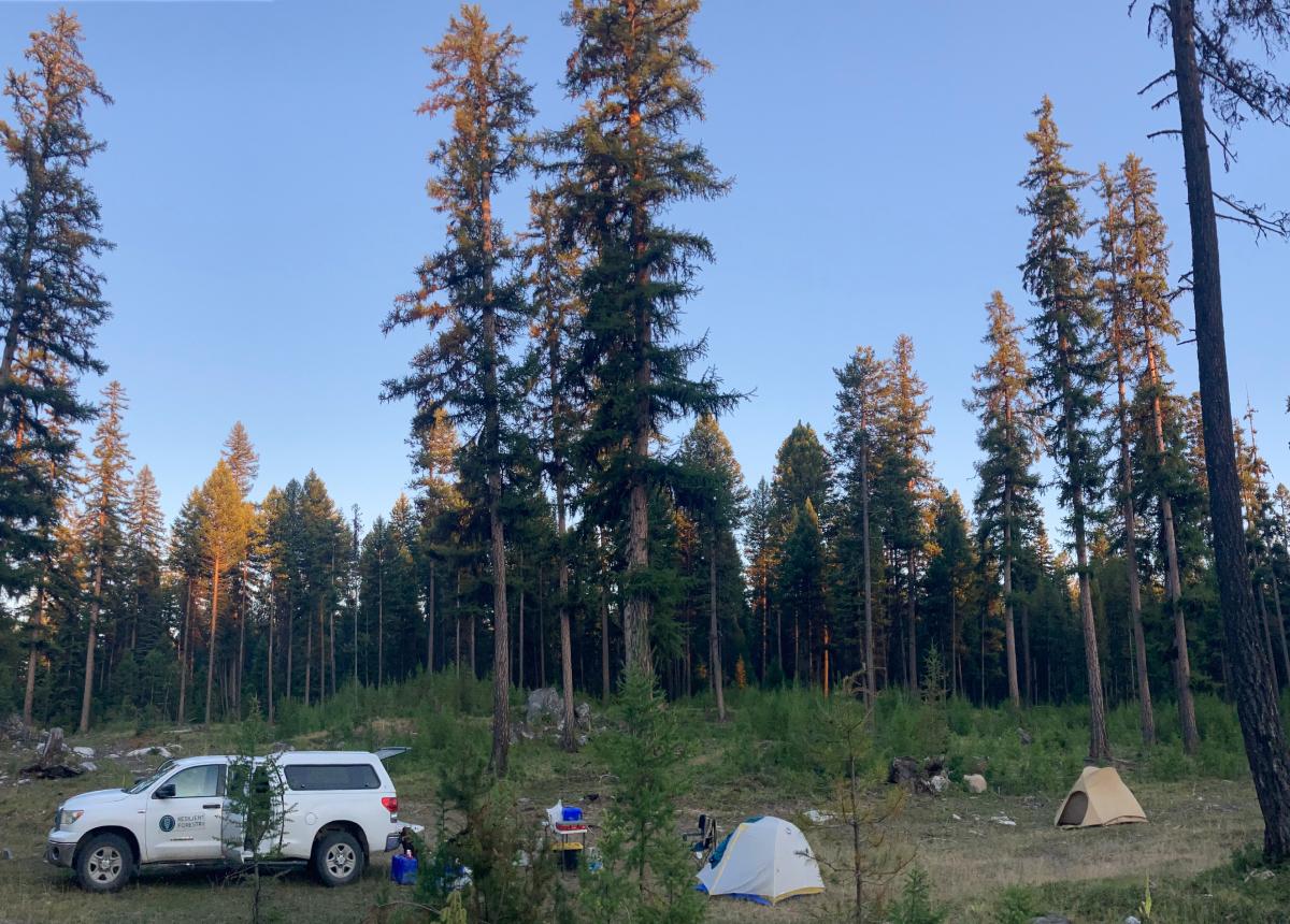
The hot sun of northeastern Washington beat down on us as we climbed out of the trusty Resilient field truck. We were dusty and aching from long, hard days traversing the hills of the Colville National Forest, but the unique importance of our mission drove us to gather our tools and head back into the woods. After all, it’s not every day you get to look for somewhere to build a time machine.
No, I’m not referring to a time machine like what you’d see in Doctor Who or Bill and Ted’s Excellent Adventure. Instead, this modeling-based time machine leverages intensive forest measurements to peer back through time and create an analytical reconstruction of what a current patch of forest looked like hundreds of years ago. The first step is to select a target year to “time travel” back to. For this research, the target year is the beginning of fire suppression in the region, around 1890. Then, a suitable ten-acre plot of forest is located and every tree, log, and stump that reached chest height before the year 1890 in the plot is mapped and measured. Lastly, forest growth models are run in reverse to turn back the sands of time and produce a dataset that numerically describes the stand as it was in 1890.
Repeating this process across many patches of forest helps land managers make better decisions by revealing what the historical conditions were for important structural metrics in these fire-adapted forests before colonial disruptions of fire regimes (LeFevre et al., 2020). This understanding of historical forest structures, species compositions, and spatial patterns informs silvicultural treatments that work to restore historical resilience to frequent fire and drought. However, current historical conditions reconstruction datasets cover a limited variety of forest types.
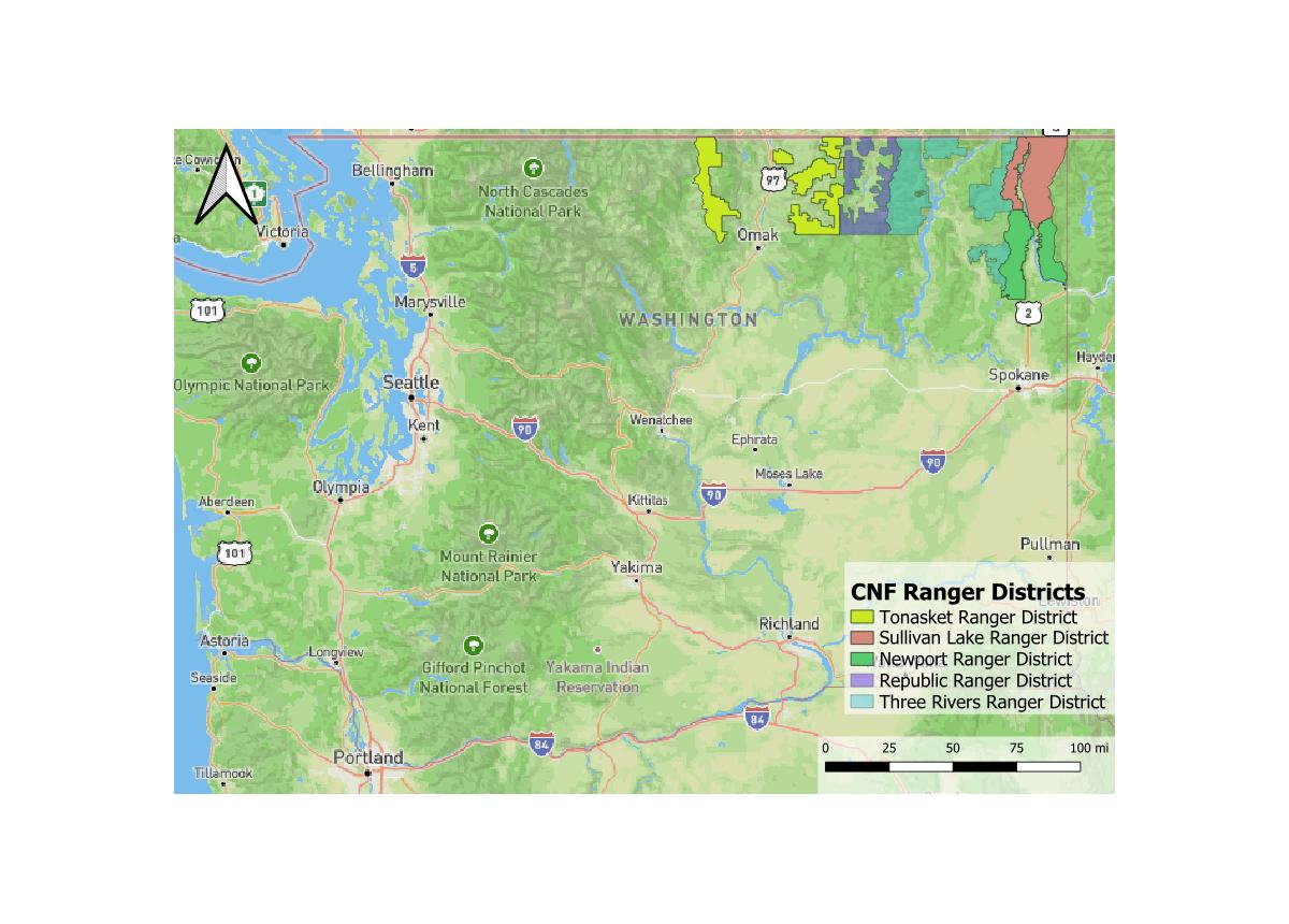
In recent years, a need was identified by northeastern Washington land managers to expand the coverage of this forest variability time machine (i.e. historical conditions dataset). In NE Washington, reconstruction datasets primarily cover warm, dry ponderosa pine forest. Cool, wetter forest types have yet to be measured. Thus, Resilient Forestry was contracted by the Washington Department of Natural Resources in 2024 to scout out potential reconstruction plot installation locations in the mesic forests of the Tonasket, Sullivan Lake, and Newport Ranger Districts of the Colville NF (Figure 1).
Part 2: Finding needles in a haystack. A very, very big haystack.
To be an ideal location for reconstruction plot installation, a forest stand must answer “yes” to the below questions:
- Old trees: Were a substantial proportion of trees in the stand alive before 1890?
- Forest type: Do stand moisture regime and plant species composition align with research needs?
- Disturbance history: Has the stand avoided significant alteration by fires or logging since 1890?
- Ease of access: Is it feasible to get to the stand?
Now, given the fact that the project area encompasses over a million acres, large patches of old growth are rare, and burned or logged areas are quite common in the region, this adds up to being no small task. The first component of this task was to use GIS and multiple geospatial datasets describing forest structure, composition, and disturbance history. We overlaid a map of the project area with a grid and systematically reviewed each cell of the grid to see if that area might answer “yes” to all the above questions (Figure 2). There were over 2,000 grid cells to check out! At the end of this process, we had identified almost 200 areas that warranted a field visit. But the GIS analysis could only show us so much— we had to go see for ourselves.
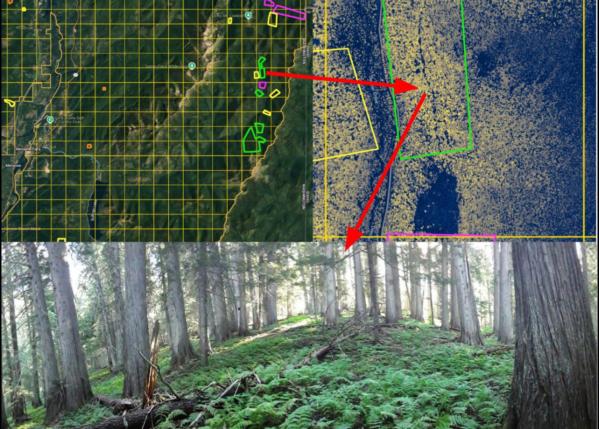
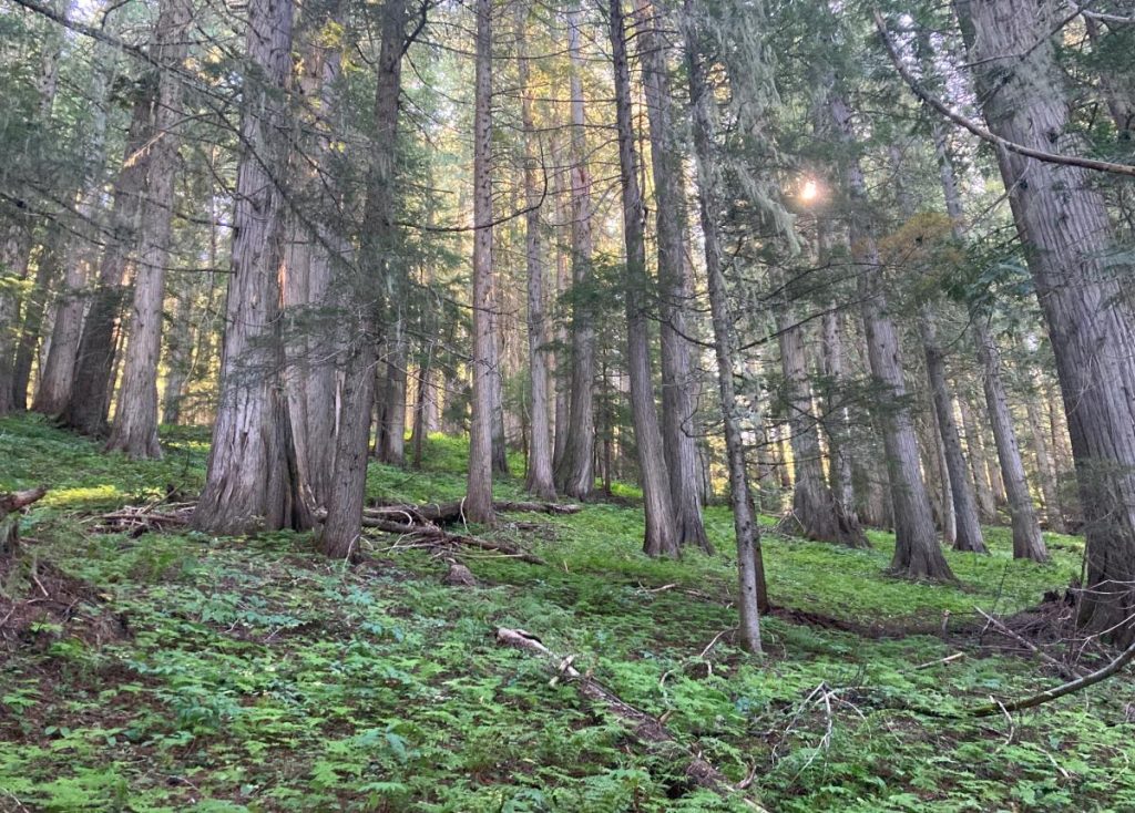
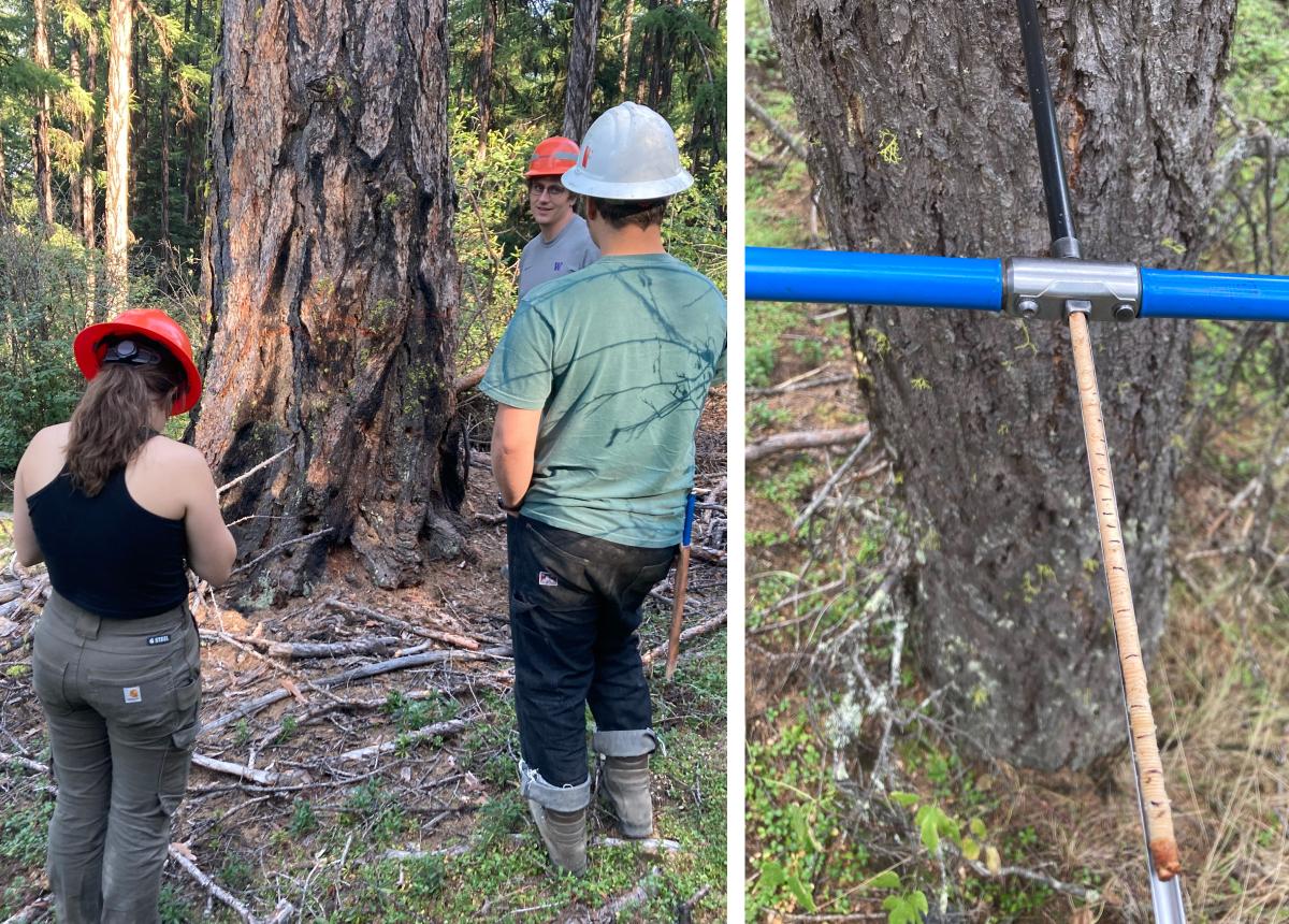
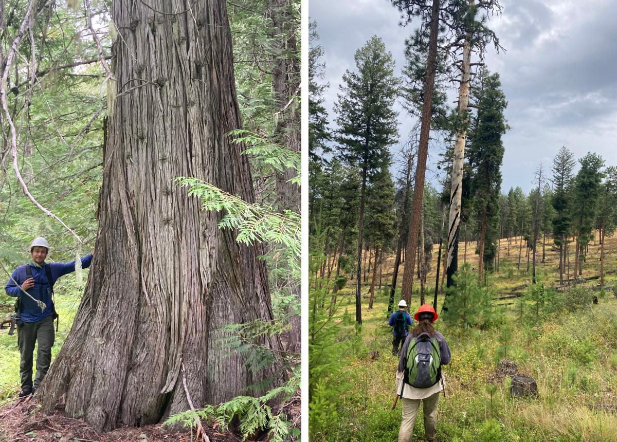
We spent the better part of August 2024 driving and hiking through the hills of the Colville National Forest, scouting areas identified during the GIS-scouting phase. Some of these areas required over an hour of involved bushwhacking from the road. At each area, we aged a sample of the trees by extracting cores and counting annual growth rings. We built some serious shoulder strength from coring all those trees, some of which were over 400 years old! Once establishing a rough age distribution, we traversed through the area we’d identified on the computer to verify the extent of suitable conditions and determine whether the stand had been disturbed by logging or fire.
Of the 40 areas we scouted, many were full of stumps, had been burnt, or simply lacked a sufficient presence of old trees. However, 19 of the areas we scouted met all the selection criteria. We found almost 700 acres of forest that could be the home of some new forest time machines! Our ability to find these areas was attributable to both some key tips from knowledgeable Forest Service employees and the effectiveness of the GIS scouting for identifying priority areas. Perhaps even more important was the perceptiveness and hard work of the Resilient Forestry field crew, which enabled us to adapt our plans on-the-fly and maximize the efficiency of our scouting effort.
Although we had to contend with pouring rain, scorching sun, and grueling bushwhacks, we all greatly enjoyed this opportunity to search out intact old forests on this significantly disturbed landscape. The possibility of installing reconstruction plots is exciting because we can learn how to adapt to the future from the history of these forests. We found it rewarding to support research that aligns so well with our mission to achieve optimal management outcomes through cutting-edge ecosystem science. And after all, who wouldn’t want to help build a time machine?
References:
LeFevre M.E., Churchill D.J., Larson A.J., Jeronimo S.M.A., Bass J., Franklin J.F., Kane V.R., 2020. Evaluating Restoration Treatment Effectiveness through a Comparison of Residual Composition, Structure, and Spatial Pattern with Historical Reference Sites. Forest Science 66, 578–588. https://doi.org/10.1093/forsci/fxaa014